Advanced use of FERRET commands in the tour will give you a good idea how useful the program can be exploring data sets. Commands to FERRET below willbe in capital letters. FERRET prompts for input with the word "yes?".
yes? SET DATA levitus_climatology
yes? SHOW DATA levitus_climatology

currently SET data sets:
1> ./levitus-climatology.des (default)
name title I J K L
TEMP TEMPERATURE 1:360 1:180 1:20 1:1
SALT SALINITY 1:360 1:180 1:20 1:1
Note that 2 variables are available; temperature and salinity. The grid is 1x1 degree, andglobal. For information on FERRET's grid indicesclick here.
Let's first display the sea surface temperature over the globe.
yes? SHADE/K=1/LEV=(-2,32,1) TEMP
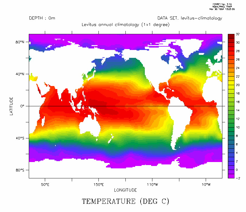
You can note --
- The `cold tongue' in the eastern equatorial Pacific
- The western Pacific equatorial warm pool
- The effects of the gulf stream in the NE Atlantic at about 60 North
- In the subtropics surface temperatures are greater in the west than in the east
Let's look now at the sea surface salinity over the globe.
yes? SHADE/K=1/LEV="()(0,49,3)(33,37,.4)" SALT
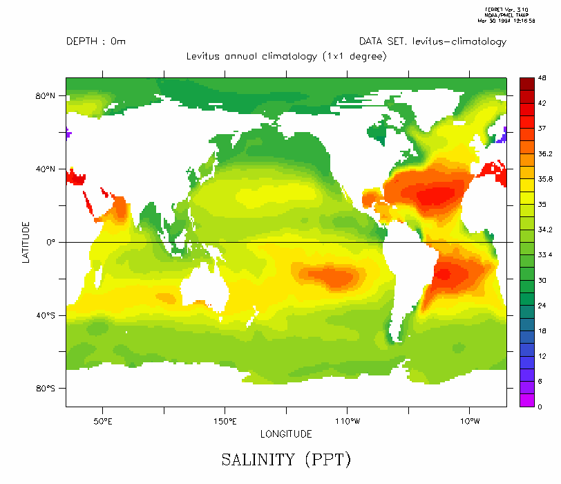
In surface salinity you can see --
- Higher salinity in the centers of the subtropical gyres
- The difference in salinity between the Mediterranean and the Baltic
- Low salinity in river outflows: the Amazon, Congo and Ganges
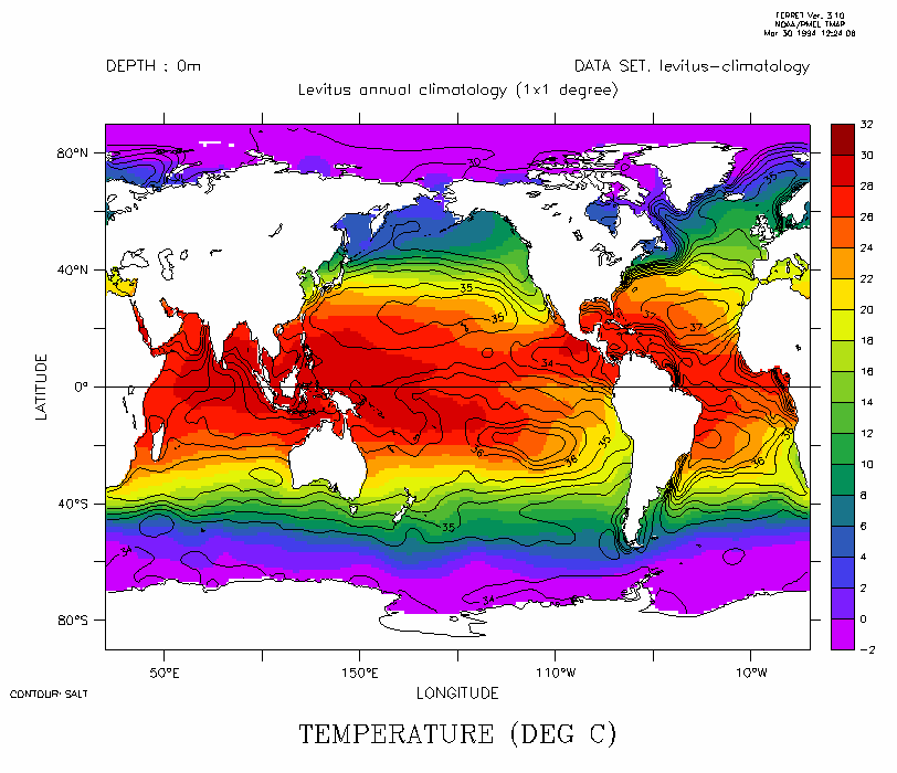
Overlay the two fields and outline the land masses. The relationship between surface temperature and salinity is not simple.
yes? SHADE/K=1/LEV=(-2,32,2) TEMP
yes? CONTOUR/OVER/K=1/LEV="()(0,49,3)(33,37,.4)" SALT
yes? GO land
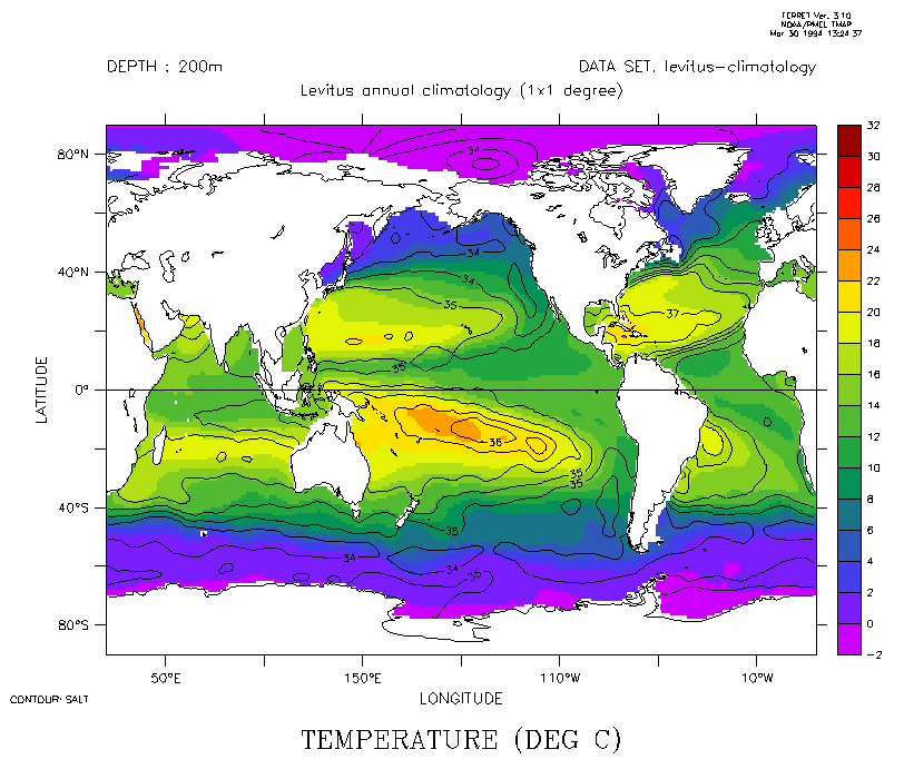
Let's look deeper. Note at 200 meters depth, temperature and salinity are more closely related.
yes? SHADE/Z=200/LEV=(-2,32,2) TEMP
yes? CONTOUR/OVER/Z=200/LEV="()(0,49,3)(33,37,.4)" SALT
yes? GO land
And next view a meridional slice -- first in the Atlantic:
yes? SHADE/X=30W/LEV=(-2,32,2) TEMP
yes? CONTOUR/OVER/X=30W/LEV="()(0,49,3)(33,37,.4)" SALT
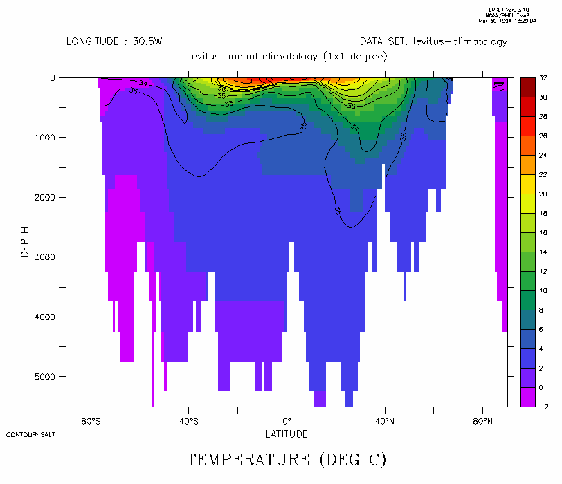
- The warm subtropical gyres are evident here
- There is correlation between temperature and salinity
- Note the Antarctic Intermediate Water's strong signal in salinity near 60 South at the surface, extending equatorward around 1000 meters
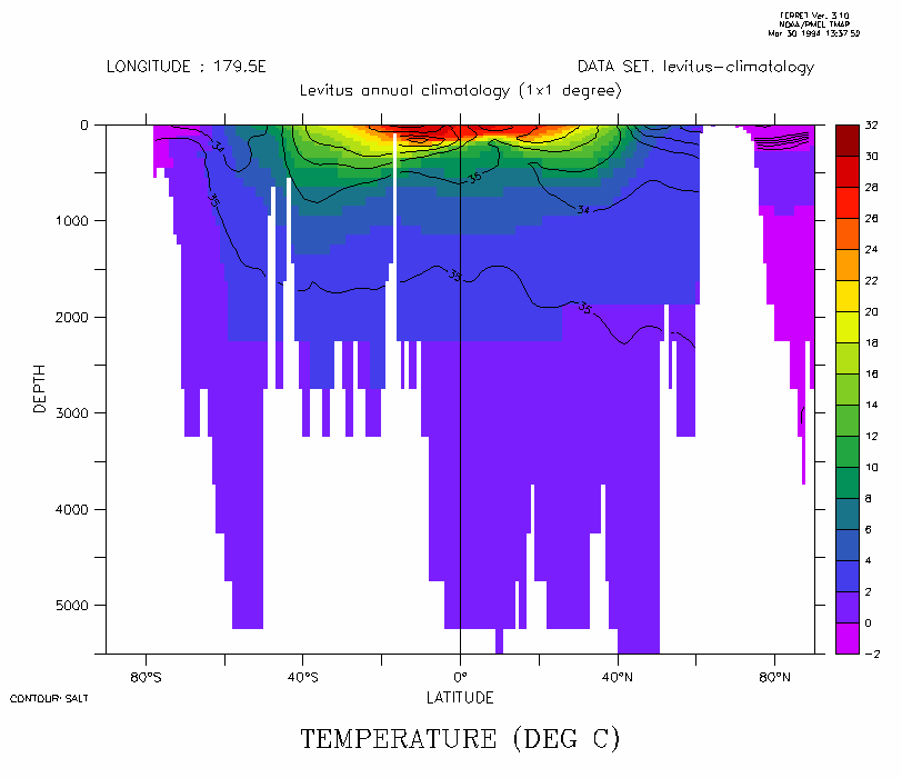
And then in the Pacific
yes? SHADE/X=180W/LEV=(-2,32,2) TEMP
yes? CONTOUR/OVER/X=180W/LEV="()(0,49,3)(33,37,.4)" SALT
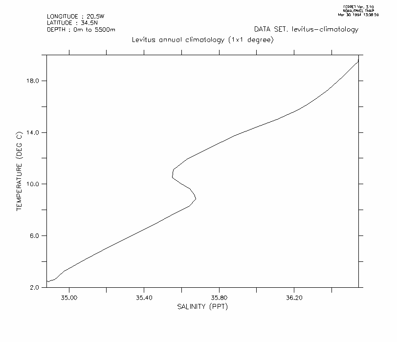
Finally, T-S diagrams may be constructed with a single "sounding", illustrating the general monotonic decrease of temperature with depth. This is in general true of salinity too but note here around 10 degrees Celsius, salinity increases -- due to inflow at depth into the Atlantic of higher salinity Mediterranean water.
yes? PLOT/VS/X=20W/Y=35N SALT,TEMP